


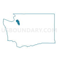
Water: Admiralty Bay, Island County, Washington
About
Outline

Summary
| Unique Area Identifier | 684493 |
| Name | Water: Admiralty Bay |
| County | Island County |
| State | Washington |
| Area (square miles) | 38.39 |
| Land Area (square miles) | 0.00 |
| Water Area (square miles) | 38.39 |
| % of Land Area | 0.00 |
| % of Water Area | 100.00 |
| Latitude of the Internal Point | 48.02182230 |
| Longtitude of the Internal Point | -122.62881980 |
Maps


Graphs
Select a template below for downloading or customizing gragh for Water: Admiralty Bay, Island County, Washington


Neighbors
Neighoring Voting District (by Name) Neighboring Voting District on the Map
- Admiralty 1 Voting District, Island County, WA
- Admiralty 2 Voting District, Island County, WA
- Austin Voting District, Island County, WA
- Bush Point 1 Voting District, Island County, WA
- Coveland Voting District, Island County, WA
- Double Bluff Voting District, Island County, WA
- Greenbank Voting District, Island County, WA
- Lagoon Point Voting District, Island County, WA
- Prairie Voting District, Island County, WA
- Water: Admiralty Inlet, Jefferson County, WA
- Water: Hood Canal Leg 23, Kitsap County, WA
- Water: Puget Sound, Island County, WA
- Water: Puget Sound Leg 23, Kitsap County, WA
- Water: Strait of Juan de Fuca, Island County, WA
Top 10 Neighboring County Subdivision (by Population) Neighboring County Subdivision on the Map
- Discovery Bay-Port Townsend CCD, Jefferson County, WA (15,833)
- South Whidbey Island CCD, Island County, WA (13,630)
- Central Whidbey Island CCD, Island County, WA (12,458)
- Kingston CCD, Kitsap County, WA (11,392)
- Oak Bay-Port Ludlow CCD, Jefferson County, WA (10,092)
Top 10 Neighboring Place (by Population) Neighboring Place on the Map
Top 10 Neighboring Unified School District (by Population) Neighboring Unified School District on the Map
- North Kitsap School District, WA (45,966)
- South Whidbey School District, WA (15,336)
- Port Townsend School District, WA (14,278)
- Chimacum School District, WA (11,350)
- Coupeville School District, WA (9,696)
Top 10 Neighboring State Legislative District Lower Chamber (by Population) Neighboring State Legislative District Lower Chamber on the Map
- State House District 10, WA (134,117)
- State House District 24, WA (132,679)
- State House District 23, WA (130,119)
Top 10 Neighboring State Legislative District Upper Chamber (by Population) Neighboring State Legislative District Upper Chamber on the Map
- State Senate District 10, WA (134,117)
- State Senate District 24, WA (132,679)
- State Senate District 23, WA (130,119)
Top 10 Neighboring 111th Congressional District (by Population) Neighboring 111th Congressional District on the Map
- Congressional District 2, WA (760,041)
- Congressional District 1, WA (739,455)
- Congressional District 6, WA (709,570)
Top 10 Neighboring Census Tract (by Population) Neighboring Census Tract on the Map
- Census Tract 9506.01, Jefferson County, WA (6,299)
- Census Tract 9503, Jefferson County, WA (6,148)
- Census Tract 9710, Island County, WA (4,776)
- Census Tract 9713, Island County, WA (4,393)
- Census Tract 9504, Jefferson County, WA (3,944)
- Census Tract 9711, Island County, WA (3,289)
- Census Tract 9718, Island County, WA (2,452)
- Census Tract 9922.01, Island County, WA (0)
- Census Tract 9901, Kitsap County, WA (0)